Publications
 Partners


The South African Weather Service has issued a yellow level 2 warning for disruptive rain leading to localised flash flooding of susceptible roads in formal/informal settlements, which is expected over the Cape Winelands, the City of Cape Town, and western parts of the Overberg Districts from Sunday afternoon until Monday morning.
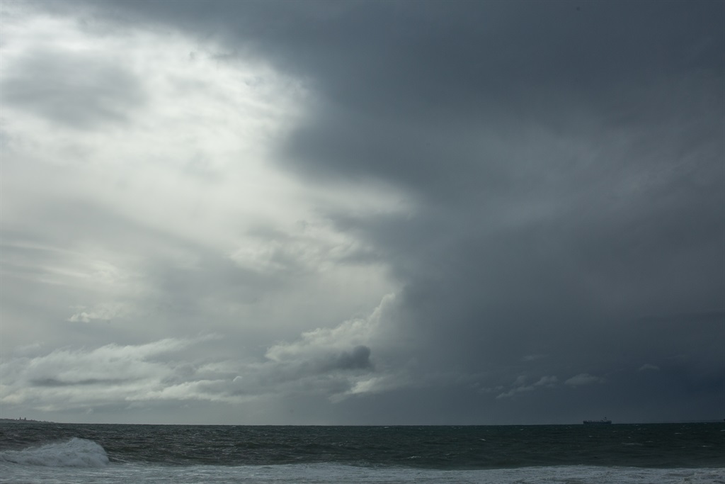
It also issued a yellow level 2 warning for coastal damaging winds and waves resulting in difficulty in navigation at sea, which is expected between Saldanha Bay and Plettenberg Bay from Sunday afternoon until Monday late evening, but until Tuesday morning for damaging waves.
There's an advisory for a well-developed cold front that is expected to make landfall over the south-western parts of the Western Cape on Sunday afternoon into Monday, dropping daytime temperatures significantly on Monday.
Maximum temperatures may be below 10°C in places over Namakwa District in the Northern Cape, as well as in the Cape Winelands, Central Karoo and interior of the Garden Route of the Western Cape Districts as well as over the interior of the Eastern Cape. General windy conditions will accompany the cold and wet weather.
The weather in your province
Gauteng will be fine and cool with morning frost in places.
The expected UVB sunburn index is high.
Morning fog is expected along the escarpment of Mpumalanga, otherwise fine and cool to cold but warm in the east, where it will be partly cloudy.
There will be morning fog patches along the escarpment of Limpopo, otherwise it will be fine and cool to warm.
The North West will also experience morning frost in the south-west, otherwise it will be fine and cool.
The Free State will have morning fog patches and frost in the south, otherwise fine and cold conditions can be expected.
There will be fog patches over the southern parts of the Northern Cape, otherwise it will be fine and cold to cool.
The wind along the coast will be light to moderate north-westerly.
The Western Cape will be partly cloudy with morning fog patches along the west and south-west coast, otherwise fine and cold but cool over the north-eastern interior.
The wind along the coast will be moderate to fresh northerly to north-westerly along south-western coast, otherwise light to moderate northerly to north-easterly.
The expected UVB sunburn index is moderate.
The western half of the Eastern Cape will be fine and cool.
It will be fine and cool in the eastern half, but cold over the northern interior. Morning frost is expected over the high grounds in the morning.
The wind along the coast will be light south-westerly, becoming light south-easterly in the evening.
KwaZulu-Natal will experience partly cloudy conditions with fog over the northern interior and isolated showers and rain along the north coast in the morning, otherwise fine and cool.
The wind along the coast will be moderate to fresh southerly to south-westerly.
The expected UVB sunburn index is high.